
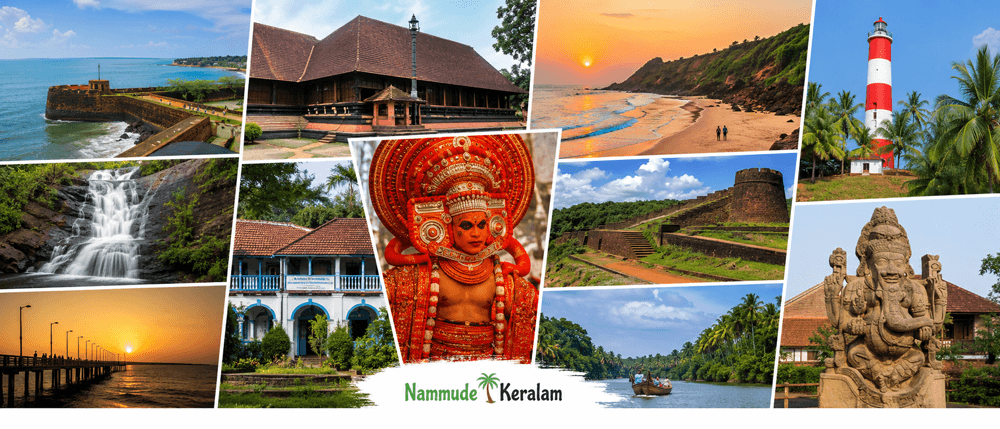
| Core Fact | Kasaragod District Details |
|---|---|
| Geographical Location / Status | Northernmost district of Keralam; coastal district on the Arabian Sea; located near the Keralam–Karnataka border |
| District Headquarters | Kasaragod |
| Total Land Area in sq km | 1,992 sq km |
| Population as per latest available Census data | 1,307,375 as per Census 2011 |
| Literacy Rate | 90.09% |
| Number of Rivers / Major Rivers | 12 rivers; major rivers include Chandragiri, Kariangode, Nileshwaram / Tejaswini, Shiriya, Uppala and Manjeshwaram |
| Revenue Divisions | Kasaragod and Kanhangad |
| Taluks | Kasaragod, Hosdurg, Manjeshwaram and Vellarikundu |
| Municipalities | Kasaragod, Kanhangad and Nileshwaram |
| Number of Grama Panchayats | 38 |
| Assembly Constituencies | Manjeshwaram, Kasaragod, Udma, Kanhangad and Trikaripur / Thrikkarippur |
| Lok Sabha Constituency / Constituencies | Kasaragod Lok Sabha Constituency |
| Official District Website | Official District Administration Website, Kasargod NIC portal |
What Makes Kasaragod Unique?
Kasaragod district is Keralam’s northern gateway.
It connects Keralam with coastal Karnataka.
Its geography includes sea coast, rivers, backwaters, laterite lands, hills and forest edges.
The district is known for multilingual culture.
Malayalam, Kannada, Tulu, Konkani and other local languages are used here.
This language mix shapes local markets, schools, worship places and festivals.
Kasaragod Keralam has a strong coastal identity.
Fishing, coconut cultivation and local trade influence daily life.
The eastern belt has hill settlements and plantation-linked livelihoods.
The district also has an important heritage identity.
Bekal Fort is one of its best-known historical landmarks.
Chandragiri Fort, Malik Ibn Dinar Mosque and Ananthapura Lake Temple add heritage value.
Theyyam, Yakshagana, Poorakkali, Kolkali, Duffmuttu and Oppana are part of the cultural profile.
Kasaragod is also important for plantation crop research.
ICAR-Central Plantation Crops Research Institute is located in Kasaragod.
It works on coconut, arecanut, cocoa and related crops.
Central University of Keralam at Periye adds academic importance.
Kasaragod at a glance is therefore not only an administrative profile.
It is also a profile of a border district, coastal district and multilingual cultural region.
Geography and Administrative Profile
Location in Keralam
Kasaragod district is located at the northern end of Keralam.
Kannur district lies to the south.
Karnataka lies to the north and east.
The Arabian Sea forms the western edge.
The district has coastal plains, midland areas and hill regions.
The Western Ghats influence the eastern landscape.
The coast supports fishing, tourism and settlement clusters.
The hill areas support plantations, forests and rural settlements.
Rivers and Natural Features
Kasaragod has 12 rivers.
Chandragiri is the longest river in the district.
It flows into the Arabian Sea near Thalangara.
Other important rivers include Kariangode, Nileshwaram, Shiriya, Uppala and Manjeshwaram.
The district also has backwater areas.
Valiyaparamba Backwaters is an important local water landscape.
Ranipuram is a key hill destination.
Bekal, Pallikkara and nearby coastal stretches are important beach areas.
Revenue Divisions
Kasaragod district has two revenue divisions:
| Revenue Division | Local Importance |
|---|---|
| Kasaragod | Serves the northern and central administrative areas |
| Kanhangad | Serves major parts of the southern and eastern district areas |
Kasaragod Taluks
Kasaragod taluks are:
| Taluk | Notes |
|---|---|
| Kasaragod | Includes the district headquarters area |
| Hosdurg | Includes Kanhangad and nearby administrative areas |
| Manjeshwaram | Northern border taluk near Karnataka |
| Vellarikundu | Eastern hill and rural taluk area |
Kasaragod Municipalities
Kasaragod municipalities are:
| Municipality | Local Role |
|---|---|
| Kasaragod Municipality | District headquarters and major civic centre |
| Kanhangad Municipality | Major urban centre in the district |
| Nileshwaram Municipality | Important town in south Kasaragod |
Panchayat and Local Governance Structure
The district has 38 grama panchayats.
These are grouped under block panchayat areas.
The district also has a District Panchayat.
Local self-government bodies manage civic services, local roads, sanitation, welfare schemes and local planning.
Major Towns and Urban Centres
Important towns and local centres include:
- Kasaragod
- Kanhangad
- Nileshwaram
- Manjeshwaram
- Kumbla
- Uppala
- Cheruvathur
- Trikaripur
- Vellarikundu
- Badiadka
- Periye
- Bekal
These places support administration, trade, transport, education and citizen services.
Major Places to Know in Kasaragod
Bekal Fort
Nearest location: Pallikkara, near Bekal.
Bekal Fort is one of the most recognized Kasaragod tourist places.
It is a 17th-century coastal fort built with laterite.
The fort is known for its sea-facing location and keyhole-shaped structure.
It is one of the major heritage anchors of Kasaragod district.
Ranipuram Hills
Nearest location: Ranipuram, reachable through Kanhangad and Panathady.
Ranipuram is a major hill destination in Kasaragod.
It is associated with Western Ghats landscapes, grasslands and forest patches.
The area is known for trekking and hill views.
It represents the eastern highland identity of Kasaragod district.
Valiyaparamba Backwaters
Nearest location: Near Nileshwaram and Valiyaparamba island.
Valiyaparamba Backwaters is one of the important backwater areas in Kasaragod Keralam.
It is fed by river systems and dotted with islands.
The area supports fishing, local livelihoods and tourism activities.
It is also linked with houseboat and backwater travel.
Chandragiri Fort
Nearest location: Near Kasaragod town and Chandragiri River.
Chandragiri Fort is a historic fort near the Chandragiri River.
It overlooks the river-mouth landscape.
The fort is associated with the region’s older political and coastal history.
It is also connected with local boating and heritage tourism.
Ananthapura Lake Temple
Nearest location: Ananthapura, near Kumbla.
Ananthapura Lake Temple is an important religious landmark in Kasaragod.
It is widely known as Keralam’s lake temple.
The temple is located in the middle of a lake.
It is connected with the Vaishnavite heritage of the region.
Citizen Services and Local Infrastructure in Kasaragod
Administrative Centers
Kasaragod district administration functions through the District Collectorate.
The District Collectorate is located at Civil Station, Vidyanagar, Kasaragod.
It handles revenue administration, disaster management, elections, development coordination and public administration.
The district has two Revenue Divisional Offices:
| Office | Location / Area |
|---|---|
| Revenue Divisional Office, Kasaragod | Kasaragod |
| Revenue Divisional Office, Kanhangad | Hosdurg / Kanhangad area |
The main taluk offices are:
- Kasaragod Taluk Office
- Hosdurg Taluk Office
- Manjeshwaram Taluk Office
- Vellarikundu Taluk Office
Main local self-government centres include:
- Kasaragod District Panchayat
- Kasaragod Municipality
- Kanhangad Municipality
- Nileshwaram Municipality
- Block panchayat offices
- Grama panchayat offices
The District Police Office serves district-level policing.
Police stations operate across major towns and rural areas.
The District Court Kasaragod is the main district-level judicial institution.
Subordinate courts and magistrate courts serve local legal needs.
Health Infrastructure
Kasaragod citizen services depend heavily on public health institutions.
Important government health institutions include:
- District Hospital, Kanhangad
- Government General Hospital, Kasaragod
- Government Medical College, Kasaragod
- Taluk hospitals
- Community Health Centres
- Primary Health Centres
- Family Health Centres
- District Medical Office
District Hospital Kanhangad and Government General Hospital Kasaragod are key public hospitals.
They support emergency, outpatient and inpatient services.
The public health network also includes PHCs, CHCs and field-level health centres.
These institutions are important for rural healthcare access.
Education Infrastructure
Kasaragod has important public and higher education institutions.
Major institutions include:
- Central University of Keralam, Periye
- Government College Kasaragod, Vidyanagar
- College of Agriculture, Padannakkad
- College of Engineering Trikaripur
- LBS College of Engineering, Kasaragod
- E.K. Nayanar Memorial Government College
- Govinda Pai Memorial Government College, Manjeshwaram
- Nehru Arts and Science College, Kanhangad
Central University of Keralam gives the district national academic relevance.
Government College Kasaragod is an important public higher education institution.
Professional colleges support engineering, agriculture and medical education needs.
Transport Infrastructure
Kasaragod has road and rail connectivity along Keralam’s northern coast.
National Highway 66 passes through the district.
It links Kasaragod with Kannur, Kozhikode, Mangaluru and other coastal cities.
Important towns on the NH corridor include:
- Trikaripur
- Cheruvathur
- Nileshwaram
- Kanhangad
- Kasaragod
- Kumbla
- Uppala
- Manjeshwaram
The major railway stations include:
- Kasaragod
- Kanhangad
- Nileshwaram
- Cheruvathur
- Trikaripur
- Kumbla
- Uppala
- Manjeshwaram
There is no airport inside Kasaragod district.
The nearest major airport is Mangaluru International Airport.
Kannur International Airport is also used by many travellers.
Main bus centres include Kasaragod, Kanhangad, Nileshwaram and Manjeshwaram.
Coastal roads, district roads and village roads connect rural areas.
Backwater and houseboat services operate in selected tourism areas.
Valiyaparamba is the main backwater tourism anchor.
Economy and Local Livelihoods
Kasaragod district has a mixed local economy.
Agriculture, fisheries, trade, education and services are important.
The district has strong plantation crop links.
Coconut, arecanut, cashew, pepper, rubber and paddy are important crops.
Coconut is especially visible across coastal and midland areas.
Arecanut is also important in many parts of the district.
Cashew cultivation is seen in laterite and plateau areas.
Rubber and other crops are found in the eastern and hilly regions.
Fisheries support coastal livelihoods.
The district’s long coastline supports fishing communities and fish landing activity.
Backwater and inland water areas support allied livelihood activities.
Tourism is linked with Bekal, Ranipuram, Valiyaparamba and heritage sites.
Tourism also supports transport, accommodation and small local businesses.
Small industries and local trade serve towns and rural markets.
The District Industries Centre and taluk industries offices support enterprise activity.
Kasaragod also has research-linked economic importance.
ICAR-CPCRI supports plantation crop research and knowledge transfer.
Central University of Keralam supports academic and service-sector activity.
Migration-linked income influences many households in North Keralam.
Current district-level remittance figures are not clearly available from official public sources.
Culture, Language, and Society
Kasaragod has one of Keralam’s most multilingual social profiles.
Malayalam is widely used.
Kannada, Tulu, Konkani and other local languages are also spoken.
This makes Kasaragod local information different from many other Keralam districts.
The district has strong Keralam and coastal Karnataka cultural influences.
Theyyam is a major ritual art tradition in North Keralam.
Yakshagana has cultural importance in the northern belt.
Poorakkali, Kolkali, Duffmuttu and Oppana are also part of the cultural landscape.
Religious heritage is visible through temples, mosques and churches.
Major religious communities live across coastal, midland and hill areas.
The district has temple festivals, Uroos festivals and church feasts.
Food culture reflects coastal and multilingual influences.
Rice, coconut, fish, local curries and regional snacks are common.
The lifestyle varies between coast, town, midland and hill areas.
Coastal settlements depend strongly on fishing and trade.
Hill areas are linked with agriculture and plantations.
Urban centres depend on trade, transport, education and government services.
Kasaragod Local Information Summary
Kasaragod district is important for administration, tourism, education and local services.
Kasaragod district administration is based at the district headquarters in Kasaragod.
The district has four taluks, three municipalities and 38 grama panchayats.
Kasaragod municipalities are Kasaragod, Kanhangad and Nileshwaram.
Kasaragod taluks are Kasaragod, Hosdurg, Manjeshwaram and Vellarikundu.
Kasaragod citizen services are mainly accessed through the Collectorate, taluk offices, municipal offices, panchayat offices, hospitals, police stations and courts.
Kasaragod tourist places include Bekal Fort, Ranipuram Hills, Valiyaparamba Backwaters, Chandragiri Fort and Ananthapura Lake Temple.
Kasaragod at a glance shows the district as a border district, coastal district, river-rich district and multilingual cultural region.
Suggested Official Sources to Verify
- Official District Administration Website
- Keralam Government Portal
- Keralam Tourism
- Census of India
- Local Self Government Department, Keralam
- Keralam Legislative Assembly
- Election Commission of India
- Chief Electoral Officer, Keralam
- Keralam Health Department
- District Court Kasaragod
- Central University of Keralam
- ICAR-Central Plantation Crops Research Institute
Frequently Asked Questions About Kasaragod
What are the taluks in Kasaragod district?
The taluks in Kasaragod district are Kasaragod, Hosdurg, Manjeshwaram and Vellarikundu. These four Kasaragod taluks support revenue administration, land records, certificates and local government services across the district.
What is Kasaragod district famous for?
Kasaragod district is famous for its multilingual culture, Keralam–Karnataka border identity, Bekal Fort, Theyyam, Yakshagana, rivers, backwaters, beaches, plantations and coastal livelihoods. It is also known for Central University of Keralam and ICAR-Central Plantation Crops Research Institute.
Which are the major tourist places in Kasaragod?
The major tourist places in Kasaragod include Bekal Fort, Ranipuram Hills, Valiyaparamba Backwaters, Chandragiri Fort and Ananthapura Lake Temple. These places represent the district’s heritage, hills, rivers, backwaters, coast and religious landmarks.